
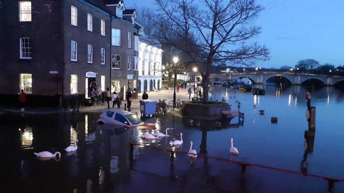
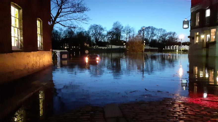
Yesterday parts of Richmond were hit by a high spring tide, which flooded areas close to the Thames.
On January 15, the Environment Agency issued a flood warning across parts of Richmond following significant rainfall from the previous day as Storm Brendan passed through the area.
Although forecasters did not predict property flooding, Teddington, Hampton and Kew were all still affected by overflowing water thanks to the Thames tidal flow.

Photo credited to Simon MacMichael from Teddington via Twitter: @simonmacmichael.
The Thames measures a total of 346km in length however, around 160km of this is considered to have a tidal flow which is also known as the Tideway.
The tideway stretches from the sea and carries on until it reaches its first lock in Teddington and will flow through Hampton, Putney, Kew, Thames Estuary, the Thames Gateway and the Pool of London.

Image credited to the Environmental Agency.
A section of a larger river affected by the tides is a tidal reach, although it may sometimes be considered a tidal river if it has been given a separate name.
The next high tide arrived this morning in Kingston at 06:30am and measured 5.72 metres in height.
In a year the River Thames tide rises and falls twice a day by up to 24ft ( seven metres).

Photo credited to Simon MacMichael from Teddington via Twitter: @simonmacmichael.


Comments: Our rules
We want our comments to be a lively and valuable part of our community - a place where readers can debate and engage with the most important local issues. The ability to comment on our stories is a privilege, not a right, however, and that privilege may be withdrawn if it is abused or misused.
Please report any comments that break our rules.
Read the rules hereLast Updated:
Report this comment Cancel